
History of Guntur District

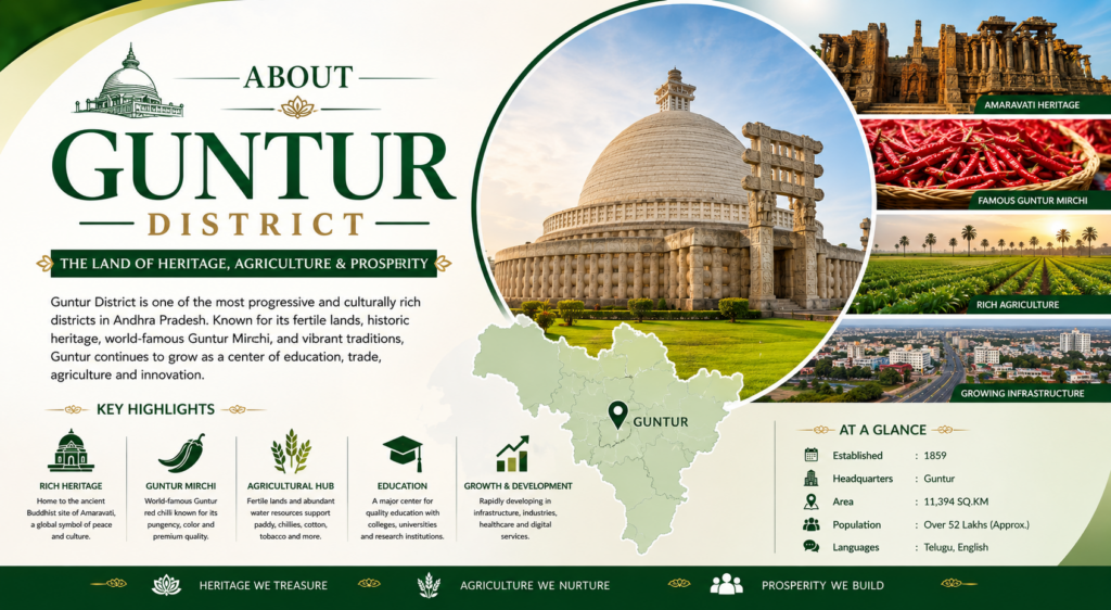
Guntur District, located in Andhra Pradesh, has a rich and vibrant history spanning more than 2,000 years. The region was an important center for Buddhism, trade, culture, and agriculture in ancient India. During the rule of the Satavahana Dynasty (1st century BCE–3rd century CE), Guntur experienced significant growth in commerce and cultural development. Amaravati, situated within the district, emerged as one of the most prominent Buddhist centers in the country, with the renowned Amaravati Stupa attracting scholars and pilgrims from across Asia.
Over the centuries, Guntur came under the rule of several powerful dynasties, including the Ikshvakus, Pallavas, Chalukyas, Kakatiyas, and the Vijayanagara Empire. These rulers contributed to the region’s progress by constructing temples, forts, and irrigation systems, while the fertile lands along the Krishna River supported thriving agricultural activities. During the British colonial period, Guntur developed into an important administrative and commercial center and was officially established as a separate district in 1904. The district also played a notable role in India’s freedom movement, with many local leaders actively participating in the struggle for independence.
Today, Guntur is widely recognized as the “Land of Mirchi” due to its status as one of the world’s largest producers and exporters of red chillies. The district is known for its agricultural prosperity, educational institutions, cultural heritage, and historical significance. Amaravati continues to stand as a symbol of Guntur’s glorious Buddhist legacy, attracting visitors and historians from around the world.
Modern Administration and Geography
Overview of Guntur District
Guntur District stands as one of the oldest and most historically significant regions in Andhra Pradesh, renowned worldwide for its vibrant Guntur Red Chillies and exceptionally fertile agricultural lands. The district is a major cultural and educational hub, deeply anchored by the ancient Amaravati Buddhist Heritage, historical monuments, and revered temples.
Modern Administration and Geography
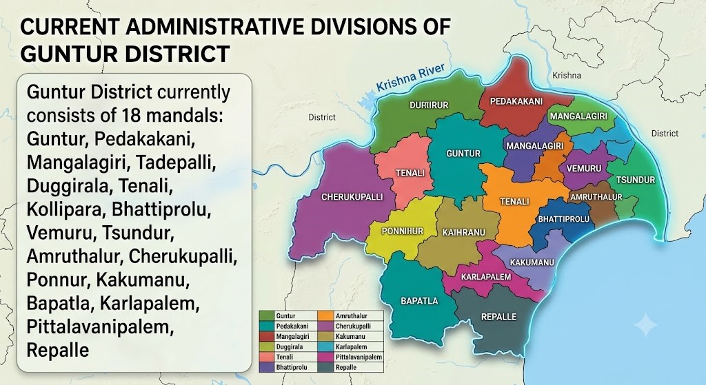
Following the state’s major administrative reorganization in April 2022, Guntur’s borders were reshaped to focus primarily on its eastern and central plains. The district currently comprises 18 mandals :
* Guntur, Pedakakani, Mangalagiri, and Tadepalli
* Duggirala, Tenali, Kollipara, and Bhattiprolu
* Vemuru, Tsundur, Amruthalur, and Cherukupalli
* Ponnur, Kakumanu, Bapatla, Karlapalem, Pittalavanipalem, and Repalle
Historical Context and Reorganization
Historically, Guntur District spanned a much larger geographical area. However, to streamline governance and decentralize administration, the district was bifurcated in 2022. During this restructuring, the coastal regions were carved out to form the new Bapatla District, while the western, upland territories were separated to establish Palnadu District. This transition left the present-day Guntur District as a more compact, urbanized, and agriculturally intensive core.
Population & GDP of Guntur District
Guntur District Population
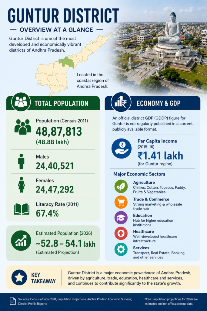
According to the 2011 Census, the population of Guntur District was 48,87,813 (48.88 lakh). The district had 24,40,521 males and 24,47,292 females, with a literacy rate of 67.4%. (Census 2011)
Estimated Population (2026):
Approximately 52.8–54.1 lakh people (based on population projections, as no official census has been conducted after 2011). (Census of India)
GDP of Guntur District
An official district GDP (GDDP) figure for Guntur is not regularly published in a current, publicly available format. However:
Guntur is one of the major economic districts of Andhra Pradesh, driven by agriculture (chillies, cotton, tobacco), trade, education, healthcare, and services.
Older district-level economic data indicate a per capita income of around ₹1.41 lakh for the Guntur region (2015–16 data). (Reddit)
If you need a figure for a website or district profile, you can use:
Population: 48.88 lakh (Census 2011)
Estimated Population (2026): ~53 lakh
Major Economic Sectors: Agriculture, Trade, Education, Healthcare, Services District-wise GDP data for Andhra Pradesh is generally reported as Gross District Domestic Product (GDDP) and varies by year. If you need the latest available GDDP of Guntur District, I can look up the most recent Andhra Pradesh government economic statistics.
Guntur District Statistics Content
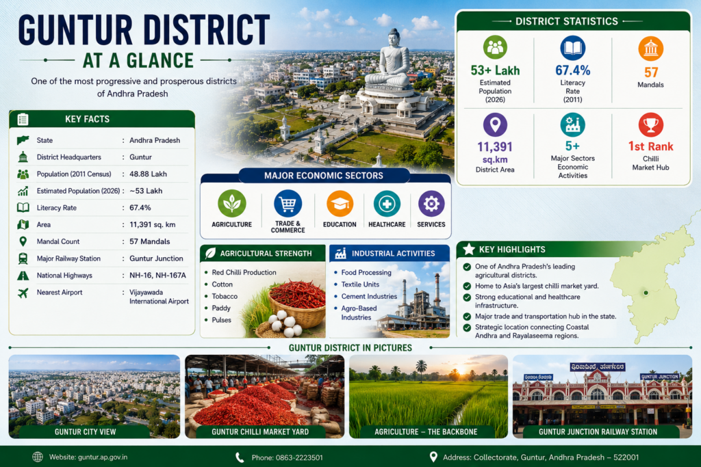
Guntur District at a Glance
📍 State: Andhra Pradesh
🏛️ District Headquarters: Guntur
👥 Population (2011 Census): 48.88 Lakh
📈 Estimated Population (2026): ~53 Lakh
📚 Literacy Rate: 67.4%
🌐 Area: 11,391 sq. km
🏘️ Mandal Count: 57 Mandals
🚉 Major Railway Station: Guntur Junction
🛣️ National Highways: NH-16, NH-167A
✈️ Nearest Airport: Vijayawada International Airport
Core Geographical Measurements of Guntur District
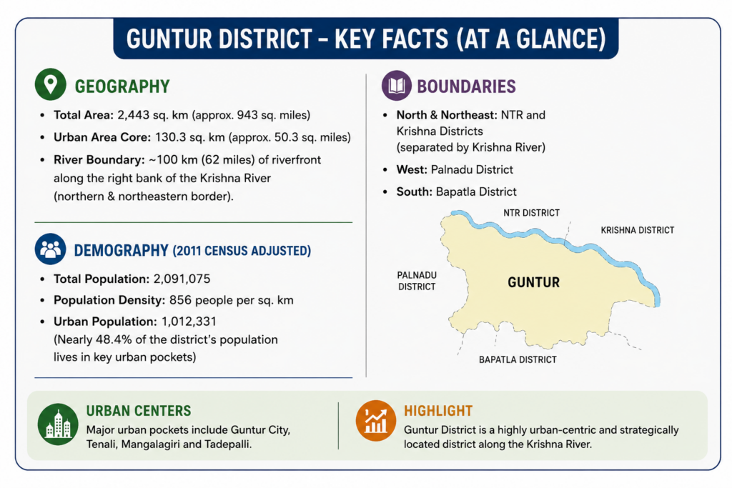
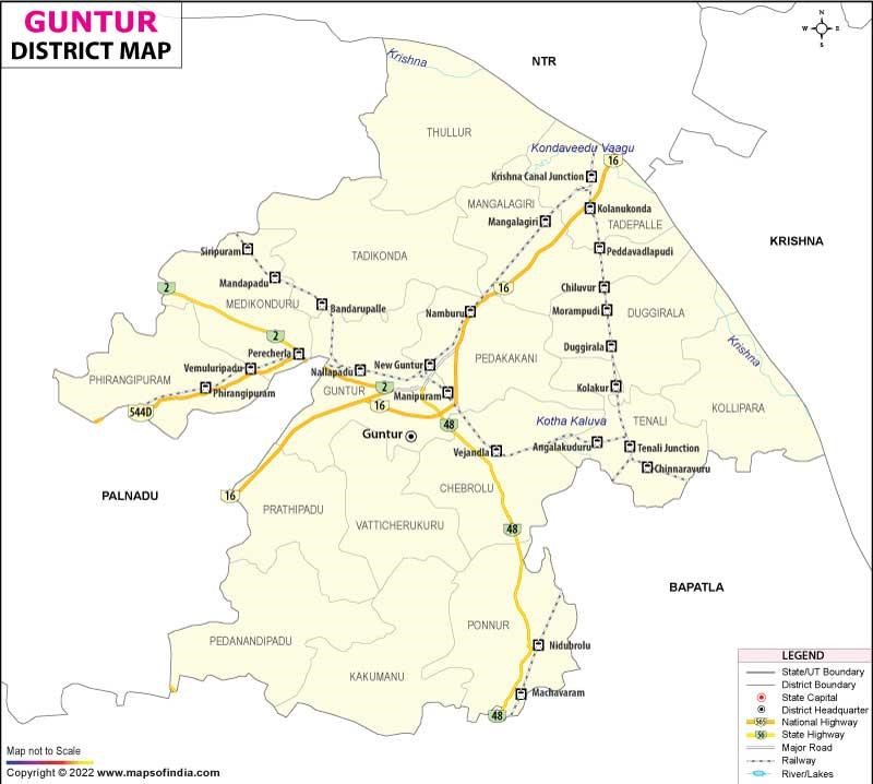
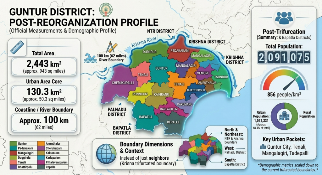
Guntur District covers an area of approximately 2,443 square kilometers and is bordered by nearly 100 kilometers of the Krishna River along its northern and northeastern boundaries. The district has a population of about 20.91 lakh people, with a population density of 856 persons per square kilometer. Nearly 48.4% of the population (10.12 lakh people) resides in urban centers such as Guntur, Tenali, Mangalagiri, and Tadepalli, making it one of the more urbanized districts in Andhra Pradesh. Strategically located along the Krishna River, Guntur is bounded by NTR and Krishna districts to the north and northeast, Palnadu district to the west, and Bapatla district to the south, contributing to its importance as a major administrative, commercial, and transportation hub in the region.
Why Visit Guntur

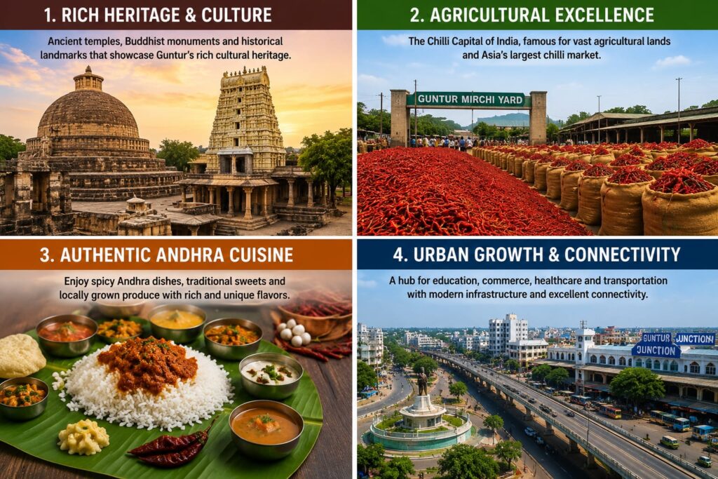
Rich Heritage &
Culture
🏛️ Rich Heritage & Culture Guntur is home to ancient temples, Buddhist monuments, and historical landmarks that showcase its rich cultural and spiritual heritage. Visitors can explore centuries-old traditions
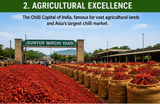
Agricultural Excellence
🌾Agricultural Excellence Known as the "Chilli Capital of India," Guntur is famous for its vast agricultural lands . and thriving chilli market. The district plays a significant role in the production of chillies, cotton, tobacco, and other crops.
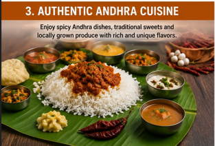
Authentic Andhra Cuisine
🍛 Authentic Andhra Cuisine Guntur offers a unique culinary experience with its spicy Andhra dishes, traditional sweets, and locally grown produce.food and rich food culture.
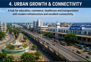
Urban Growth & Connectivity
With major urban centers such as Guntur, Tenali, Mangalagiri, and Tadepalli, the district is a hub for education, commerce, healthcare, and transportation. modern infrastructure make it an important destination for business and travel.
Guntur District
Exploring the 18 key mandals, heritage towns, and economic centers
Guntur
| Category | District Headquarters & Municipal Corporation |
| Estimated GDP | ₹18,500 Crores ($2.2B USD) |
| Population | Approx. 743,269 (City Corporate Area) |
| Area | 159.46 sq. km |
| Economy | Chilli & Cotton Trading, Medical Services, Education |
| Major Crops | Chilli, Cotton, Paddy |
| Known For | Asia's Largest Chilli Market Yard |
| Tourist Places | Uppalapadu Bird Sanctuary, Jinna Tower |
| Special Feature | Major administrative and institutional hub of the district |
Pedakakani
| Category | Spiritual Suburban Mandal |
| Estimated GDP | ₹1,450 Crores |
| Population | Approx. 72,400 (Mandal total) |
| Area | 94.82 sq. km |
| Economy | Pilgrimage Tourism, Agro-processing, Brick Kilns |
| Major Crops | Paddy, Chilli, Maize |
| Known For | Sri Bramaramba Malleswara Swamy Temple |
| Tourist Places | Kakani Shiva Temple, Local Holy Shrines |
| Special Feature | Highly famous center for Rahu-Ketu Dosha Pujas |
Mangalagiri
| Category | Heritage Temple Town & IT Hub |
| Estimated GDP | ₹5,200 Crores |
| Population | Approx. 107,588 (Town Area) |
| Area | 27.14 sq. km (Town limits) |
| Economy | Handloom Textiles, Tourism, IT & Healthcare Services |
| Major Crops | Paddy, Cotton |
| Known For | Mangalagiri Handloom Sarees & Fabrics |
| Tourist Places | Panakala Lakshmi Narasimha Swamy Temple |
| Special Feature | Home to AIIMS Guntur and emerging IT Parks |
Tadepalle
| Category | Urban & Institutional Mandal |
| Estimated GDP | ₹3,100 Crores |
| Population | Approx. 112,800 (Urban Agglomeration) |
| Area | 24.70 sq. km |
| Economy | Real Estate, Administration, Retail Trade, Logistics |
| Major Crops | Paddy, Turmeric, Vegetables |
| Known For | Proximity to Krishna River & Vijayawada City |
| Tourist Places | Undavalli Caves (Nearby), Prakasam Barrage views |
| Special Feature | Key institutional corridor connecting the urban delta zones |
Tenali
| Category | Major Municipality & Cultural Center |
| Estimated GDP | ₹4,850 Crores |
| Population | Approx. 164,753 |
| Area | 15.11 sq. km |
| Economy | Agriculture, Gold Trade, Brass Metal Industry |
| Major Crops | Paddy, Black Gram, Turmeric |
| Known For | Three Canals, Art, Literature, and Theater |
| Tourist Places | Vaikuntapuram Temple, Chinaravuru Park |
| Special Feature | Widely known as the "Paris of Andhra" |
Kollipara
| Category | River Delta Agrarian Mandal |
| Estimated GDP | ₹1,150 Crores |
| Population | Approx. 56,200 |
| Area | 123.60 sq. km |
| Economy | Intensive Agriculture, Dairy Farming, Sugarcane Processing |
| Major Crops | Paddy, Sugarcane, Turmeric, Banana |
| Known For | Highly Fertile Silt Soils of the Krishna Riverbank |
| Tourist Places | Scenic Riverfront Farms, Local Village Temples |
| Special Feature | Abundant water supply through delta canal channels |
Duggirala
| Category | Major Agricultural Trading Hub |
| Estimated GDP | ₹2,350 Crores |
| Population | Approx. 61,850 |
| Area | 104.20 sq. km |
| Economy | Turmeric Trading Yards, Cold Storage, Agro-Logistics |
| Major Crops | Turmeric, Paddy, Jaggery |
| Known For | The Globally Renowned Duggirala Turmeric Market |
| Tourist Places | Local Historic Shrines, Bustling Commodity Trading Yards |
| Special Feature | Dictates commercial turmeric pricing across South Asia |
Chebrolu
| Category | Historical & Archeological Mandal |
| Estimated GDP | ₹1,200 Crores |
| Population | Approx. 54,300 |
| Area | 111.45 sq. km |
| Economy | Agriculture, Terracotta/Clay arts, Education |
| Major Crops | Paddy, Cotton, Red Gram |
| Known For | Chaturmukha Brahma Temple (Rare Shrine) |
| Tourist Places | Ancient Temples of Chalukya Era, Archeological sites |
| Special Feature | Known historically as 'Sambhole', an ancient military post |
Ponnur
| Category | Temple Town & Agro-Industry |
| Estimated GDP | ₹1,950 Crores |
| Population | Approx. 59,967 (Town limits) |
| Area | 25.64 sq. km |
| Economy | Rice Mills, Brick Kilns, Pilgrimage Tourism |
| Major Crops | Paddy, Vegetables |
| Known For | Massive Monolithic Idols |
| Tourist Places | Sakshi Bhavanarayana Swamy Temple |
| Special Feature | Famous for large Anjaneya Swamy & Garutmantha statues |
Vatticherukuru
| Category | Agrarian Plain Mandal |
| Estimated GDP | ₹980 Crores |
| Population | Approx. 44,600 |
| Area | 98.50 sq. km |
| Economy | Agriculture, Animal Husbandry, Local Retail |
| Major Crops | Chilli, Cotton, Black Gram |
| Known For | Traditional rural architecture and strong community farming |
| Tourist Places | Historic local village shrines |
| Special Feature | Forms the transition zone between western plains and central delta |
Prathipadu
| Category | Commercial Farming Mandal |
| Estimated GDP | ₹1,600 Crores |
| Population | Approx. 68,500 |
| Area | 132.80 sq. km |
| Economy | Cotton Ginning Mills, Chilli Cold Storages |
| Major Crops | Chilli, Cotton, Tobacco |
| Known For | Expansive Cash Crop plantations along transport highways |
| Tourist Places | Local historic temples and structural village stepwells |
| Special Feature | Dotted with industrial cold storage facilities |
Medikonduru
| Category | Agro-Industrial Mandal |
| Estimated GDP | ₹1,100 Crores |
| Population | Approx. 51,200 |
| Area | 115.40 sq. km |
| Economy | Stone Crushing Mills, Cotton Ginning, Rice Milling |
| Major Crops | Cotton, Chilli, Pulses |
| Known For | Abundant small hills and heavy mineral transport |
| Tourist Places | Scenic hillocks and surrounding reserve landscapes |
| Special Feature | Supplies essential building materials and crushed stones to the district |
Phirangipuram
| Category | Historical Heritage Mandal |
| Estimated GDP | ₹1,050 Crores |
| Population | Approx. 58,900 |
| Area | 142.10 sq. km |
| Economy | Agriculture, Quarrying, Educational Shrines |
| Major Crops | Cotton, Chilli, Millets |
| Known For | Historic Infant Jesus Shrine & Mount Mary Hill |
| Tourist Places | Phirangipuram Church, Kondaveedu Fort foothill trails |
| Special Feature | Deeply connected with historic cultural and linguistic integration |
Tadikonda
| Category | Strategic Suburban Mandal |
| Estimated GDP | ₹1,800 Crores |
| Population | Approx. 63,400 |
| Area | 128.60 sq. km |
| Economy | Real Estate, Agriculture, Institutional Infrastructure |
| Major Crops | Chilli, Cotton, Paddy |
| Known For | Proximity to the administrative institutional zones |
| Tourist Places | Local Venkateswara Swamy Temple, Open Greenscapes |
| Special Feature | Sits right inside the primary geopolitical corridor of the region |
Pedanandipadu
| Category | Agrarian Educational Mandal |
| Estimated GDP | ₹1,120 Crores |
| Population | Approx. 48,200 |
| Area | 118.90 sq. km |
| Economy | Agriculture, Spinning Mills, Rural Banking Systems |
| Major Crops | Chilli, Cotton, Bengal Gram |
| Known For | High literacy rates and historic political peasant movements |
| Tourist Places | Sita Ramaswamy Temple, Local Heritage Schools |
| Special Feature | An economically progressive and highly literate rural sector |
Kakumanu
| Category | Rural Delta Boundary Mandal |
| Estimated GDP | ₹850 Crores |
| Population | Approx. 39,400 |
| Area | 94.10 sq. km |
| Economy | Paddy Cultivation, Dairy Cooperatives, Fish farming |
| Major Crops | Paddy, Black Gram, Cotton |
| Known For | Vast interconnected network of minor crop canals |
| Tourist Places | Ancient local step-temples and canal check-dams |
| Special Feature | Rich alluvial soil beds supporting zero-tillage pulse farming |
Tsundur
| Category | Central Delta Farming Mandal |
| Estimated GDP | ₹920 Crores |
| Population | Approx. 46,750 |
| Area | 102.30 sq. km |
| Economy | Paddy Harvesting, Agricultural Labor, Rural Crafts |
| Major Crops | Paddy, Banana, Black Gram |
| Known For | Extensive, uninterrupted fields of vibrant green paddy rice |
| Tourist Places | Scenic rural landscapes, Local village community shrines |
| Special Feature | Deeply integrated with the core railway line networks |
Amruthalur
| Category | Deep Delta Agrarian Mandal |
| Estimated GDP | ₹890 Crores |
| Population | Approx. 41,300 |
| Area | 96.80 sq. km |
| Economy | Rice Mills, Aquaculture Channels, Organic Farming |
| Major Crops | Paddy, Turmeric, Black Gram |
| Known For | Traditional community festivals and rich water systems |
| Tourist Places | Historic local temples, Interlocking canal paths |
| Special Feature | Boasts highly efficient and deeply rooted traditional canal farming styles |